Geologically, the islands of the Japanese archipelago represent nothing more than the highest portions of a vast mountain system facing the eastern coasts of the Asian continent, from which the intermediate depressions are detached from the seas occupying the depressions.
In the Japanese stratigraphic series, all known systems are more or less completely represented, with the exception of the Archean. The oldest known formations still today belong to the Paleozoic, widespread throughout the country, represented by various types of schists accompanied by igneous rocks such as granite, gabbro, serpentine, etc. In the upper layers pyroxenite and phyllite prevail. The Mesozoic has a limited extension. Triassic marine and estuarial deposits are distributed in small areas in the provinces of Kumamoto, Tokushima, Miyagi, Gifu, Hiroshima and Yamaguchi. The Jurassic is represented by deposits (sandstone, slate, tuffaceous conglomerates, limestone) that emerge especially in the regions of Yamaguchi, Fukushima and Miyagi. The Cretaceous, very rich in ammonites, it appears frequently in southern Japan (provinces of Kii and Shikoku); in the north it forms narrow strips or small areas scattered here and there. The Cenozoic is abundant and extensive and includes gravels, sands, clays, sandstones, conglomerates and tuffs (these sometimes in layers of colossal power), often interspersed with limestone, dolomite, marl, lignite and coal. The major Japanese coalfields (Kyūshū and Yezo) belong to this geological age. Important are the deposits, rich in fossil molluscs, of the Neogene, very widespread, especially in the north. Liparite, andesite and basalts appear as igneous rocks. The Neozoic occupies large areas east of Yezo, in the north and center of Hondo and west and center of Kyūshū, forming high plains and coastal and river terraces: it includes sands, gravels and clays. Recent calculations show that the Cenozoic and its accompanying recent igneous rocks alone occupy about ⅔ of the total area of Japan. If the data of geology, eg. the presence on the mountains of marine deposits of the Tertiary, lead to the supposition that the islands of the archipelago arose from the sea and their shape, at least in the essential features, was fixed in geologically recent times, on the other hand, the layers of schists and biotite schists, to be considered belonging to the Archaic, emerging here and there throughout the country, suggest that the structure of the whole archipelago was formed in much older times. In the Cenozoic, therefore, the tectonic activity sketched the relief, to which subsequently and up to our days, more or less profound modifications made the
According to healthinclude, the relief of the country is very irregular and, generally, harsh, especially in the regions where the endogenous activity is, or has been, intense. No element of it, valley, chain or plateau, crosses the country from one sea to another or forms its central framework. Bold ridges, steep massifs, mountain chains, usually short, often fringed with volcanic cones, interrupted here and there by fractures or depressions, always covered by a varied and luxuriant vegetation, limit or separate plateaus or plains, often carpeted by lava erusions and furrowed by steep streams, unsuitable for navigation. Characteristic feature in the Japanese relief is a vast central area of tectonic depression, in which to the south is the Fuji, called with the Naumann “Fossa Magna”, which, dividing Hondo in a transversal sense,
In northern Japan (excluding Yezo, which we are talking about in the relative item) the mountain range of Mt Ōu, a central cordillera of Liparitic tuff and other Cenozoic rocks, rich in volcanic cones, constitutes the watershed line between the Pacific and the Sea of Japan. To the east of it the Mt. Kitakami and Abukuma, separated by the Sendai bay, constitute two ancient massifs (granite and schist), with extremely irregular plastic, both for the alternation of periods of aging and rejuvenation, and for the action deep of the erosion that has given rise to a very intricate system of valleys in every direction and direction. The highest peaks are Hayachine (1940 m.) And Nakadake (1679). To the west of Mt Ōu, a series of volcanic ridges, with an average height of 4-500 m., Called the Dewa Hills, they run from north to south separated from the central chain by a succession of valleys crossed by rivers. Towards the south their height increases and they end in the granite massif of Mt Sangoku with high peaks, including Asahidake (2144 m.), The highest in northern Japan.
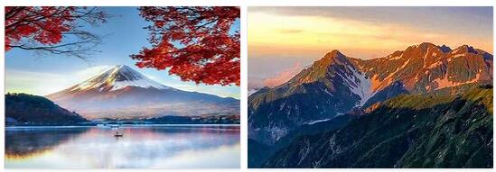
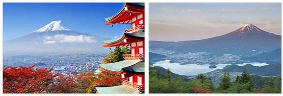
The region surrounding the Fossa Magna is the most disturbed and irregular, where the most diverse tectonic elements converge and the country’s greatest peaks rise, including the highest, Fuji (3778 m.). To the east, the Tōkyō plain, the largest of all, due to its privileged position which, both from the sea and through the central depression, makes it easily accessible, was by nature the best prepared to centralize modern life in a large metropolis. of the nation. At the western limits of the Fossa, to the west, that is, of the line formed by the Hime and Fuji rivers and by the Suwa lake, an extremely harsh alpine landscape extends, formed by gneissic basal rocks of the Paleozoic, on which granite and porphyritic effusions have given rise to steep peaks, peaks, sharp cones and gigantic massifs, almost always covered with snow and rich on the forest sides. It is the region of the so-called Japanese Alps, consisting of the three parallel ranges of the Hida, Kiso and Akaishi Mountains. The long zone of shales that make up the latter reaches south to the tip of the Atsumi peninsula and disappears, degrading into the Ise Sea; it reappears, then, in the opposite peninsula of Shima, to form the chain of the Kii Mountains, which crosses the entire peninsula of the same name culminating with the top of the Ōmine (1815 m.). Continuing, the area descends to the sea near Wakayama, and rises again on the opposite island of Shikoku, of which it forms the ridge of the same name, then, interrupted by the depression of the Inland Sea, continues in southern Kyushu, where its highest points exceed the 1700 meters.

